File:MapNanMadolComplex.png
No higher resolution available.
MapNanMadolComplex.png (550 × 500 pixels, file size: 352 KB, MIME type: image/png)
Summary
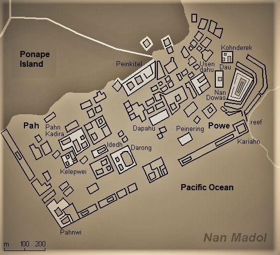
Nan Madol Complex map, Ponape Island.
File history
Click on a date/time to view the file as it appeared at that time.
| Date/Time | Thumbnail | Dimensions | User | Comment | |
|---|---|---|---|---|---|
| current | 01:45, 11 July 2022 | | 550 × 500 (352 KB) | Ywhateley (talk | contribs) | Nan Madol Complex map, Ponape Island. |
You cannot overwrite this file.
File usage
The following page uses this file: